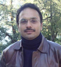
"Invention comes from the innocent imagination but innovation comes from vision."

I joined Department of Civil Engineering, IIT Guwahati in June 2015. Since then, I have been teaching and research in different areas of Geomatics and Earth Science. In summer semester (Jul-Dec), I offer "Precision Remote Sensing", which is a Post Graduate course and covers precision remote sensing technologies, namely GPS, LiDAR, Photogrammetry, and Bathemetry. In winter semester (Jan-May), I offer two Under Graduate courses, namely, "Surveying" and "Surveying Laboratory". My major research areas are airborne data acquisition and terrestrial data acquisition for 3D mapping. In addition, for any geospatial project or application, I provide solutions in many dimensions including 'understanding requirements of the project', conceptualization of data acquistion', 'generation of appropriate specifications', 'methodology development for execution strategy in field for data acquisition', and 'proof of the concepts'.
For airborne projects, I provide flight planning solutions for airborne data acquisition. Specially, if a project uses new sensors and aerial vehicles (like UAV) with new project requirements, I provide solutions for the conceptualization of data acquisition process, proof of the concept, and execution strategy in field for data acquisition. Similarly, for terrestrial data acquisition work, I derive various strategies of data acquisition with minimum time for a specific geospatial application.
EDUCATION
• 2009 - 2013
Doctor of Philosohpy (PhD)
IIT Kanpur, Kanpur, India.
• 2003 - 2005
MTech (Master of Technology)
IIT Kanpur, Kanpur, India.
• 1997 - 2001
BE (Bachelor of Engineering)
M.B.M. Engineering College, J.N.V. University,
Jodhpur, India
AWARDS & DISTINCTIONS
• Best Research Paper Award (paper titled: “GCP collection for CORONA satellite photographs: Issues and Methodology”) from Indian Society of Remote Sensing, 2006.
• Doctoral Scholarship by MHRD, Government of India from Jan 2009-Dec 2012.
• GATE (Graduate Aptitude Test of Engineering) Scholarship by MHRD, Government of India.
• Hindustan Zinc Scholarship for UG Degree in Engineering.
MY RESEARCH
1. Airborne and Terrestrial Data Acquisition
- Physical modelling
- Integration of multiple data acquisition technologies
- Mission planning and flight planning for airborne data acquisition
2. Precision Remote Sensing Technologies
- Photogrammetry, LiDAR, and GPS
- Field work for geospatial data acquisition for historical images and data
- Error analysis and estimation for precision technologies for their integration
- Synthetic simulation for data acquisition with precision technologies
- Planning for field work for data acquisition with precision technologies
3. Low Cost Method Development
- Utilization of small and low cost sensors to solve new problems of engineering significance
- Sensor calibration
- Application of low cost sensors for variety of problems
4. Solving Social Issues
- Analysis of impact of scientific problems on society like problems of land fragmentation, flash floods, urban traffic, climate change, bridge health etc.
- Modelling of scientific problems with perspective of social impact
- Identifying and utilizing appropriate remote sensing technologies for solving social issues
- Soft computing for solving problems to study their impact on social order and setup